Copernicus Land Monitoring Service – CLC+ product
- Framework: EEA (European Environment Agency) project
- Duration: 03.2021 –
- Contributors: GAF AG (Munich, Germany); GeoVille GmbH (Innsbruck, Austria); Z_GIS (Salzburg, Austria)
- More info: https://land.copernicus.eu/pan-european/clc-plus
- My role: Project associate as consulting partner
- Contact person: Stefan Lang (Z_GIS) – stefan.lang@plus.ac.at
The European Environment Agency (EEA), as one of the “Entrusted Entities” implementing the Copernicus Land Monitoring Service (CLMS) on behalf of the European Commission DG Internal Market, Industry, Entrepreneurship and SMEs (DG GROW), has started to develop and implement a new series of products, the so called CLC+ suite of products. CLC+ complements and extents the suite of currently existing CLMS products to better align with increasing requirements for European Land Cover Land Use (LC/LU) monitoring and reporting obligations. This process of development is also called the “2nd generation CORINE Land Cover (CLC)” and the suite of products resulting are referred to as “CLC+”.
The CLC+ suite of products becomes part of the new European baseline for LC/LU monitoring for the decade to come, and the CLC+ Core database (one of the components of CLC+) allows to derive tailored products (so called instances) for support to key EU policy needs through the full policy cycle, as well as to specific needs as expressed by stakeholders in the Member States. Important first use-cases for CLC+ Core instances are around monitoring, reporting and validation to support the implementation of the Regulation on the inclusion of greenhouse gas emissions and removals from land use, land use change and forestry (LULUCF).
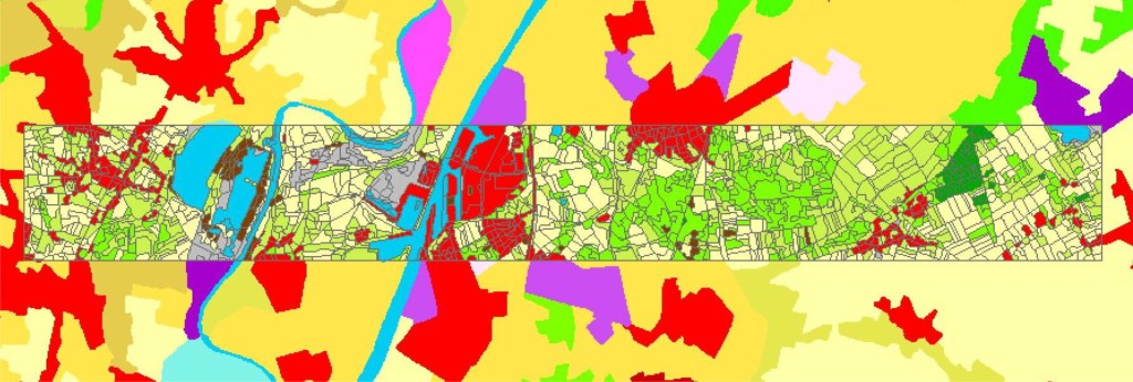
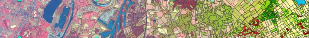
The CLC+ Backbone component produces a detailed wall to wall geometric vector reference layer with basic thematic content (18 classes) and a 12-class 10m spatial resolution raster product. The CLC+ Core component will deliver a consistent multi-use grid-based Land Cover/Land Use (LC/LU) hybrid data repository. By implementing a flexible data handling approach, CLC+ Core will incorporate existing and future European CLMS products and various national LC/LU products using a standardized integration approach in line with the EAGLE data model.
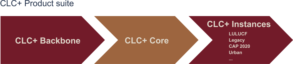
The main use-case for CLC+ Core is to derive tailor made LC/LU products (so called “Instances”), on a 100m grid level, based on a on-demand combination of available (EAGLE harmonized) LC/LU information. This allows to combine previously non harmonized datasets in new ways, in particular LC information coming from CLMS products with specific land use (LU) information from the countries.
Source: https://land.copernicus.eu/pan-european/clc-plus
As a consulting partner, our tasks included supporting the development process for our partners (GeoVille GmbH – Innsbruck & GAF AG – Munich). In the framework of the project, we contributed to the development and evaluation of the vector product through a scientific approach, a review of the methodology used and systematic testing in several regions in Europe.