
Multiscale mapping of common milkweed
- Framework: University Project/Professional Internship
– University of Szeged, Department of Geoinformatics, Physical and Environmental Geography
– Collaboration with Hungarian Academy of Sciences, Department of Soil Mapping and Environmental Informatics - Duration: 02.2017 – 03.2019
- Contributors: Levente Papp, Boudewijn van Leeuwen, Péter Szilassi, Zalán Tobak, József Szatmári (University of Szeged), Mátyás Árvai, János Mészáros, László Pásztor (Hungarian Academy of Sciences)
- Contact person: Levente Papp – papplevente9610@gmail.com & Péter Szilassi – toto@geo.u-szeged.hu

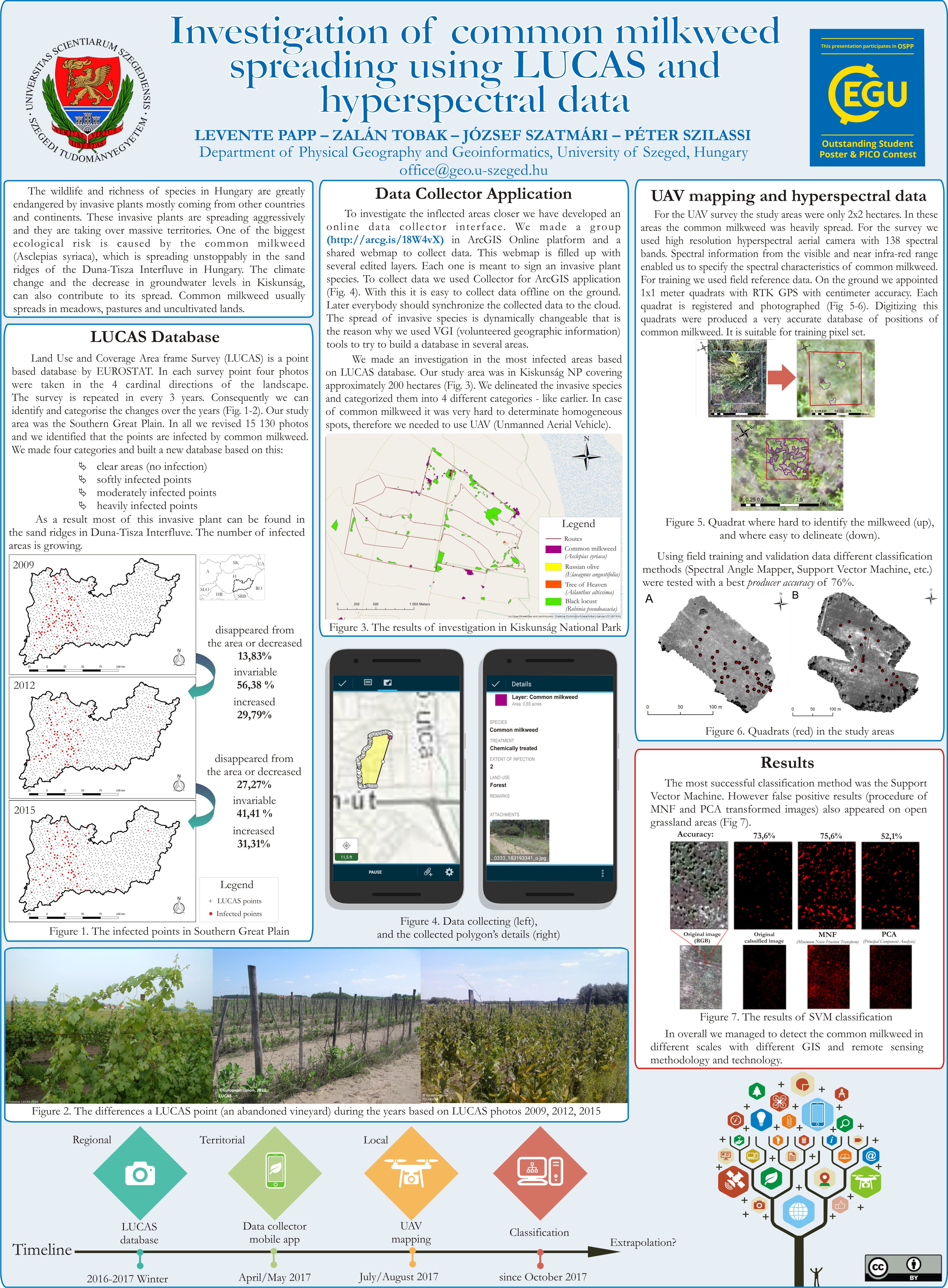
The wildlife and richness of species in Hungary are greatly endangered by invasive plants mostly coming from other countries and continents. These invasive plants are spreading aggressively and they are taking over massive territories. One of the biggest ecological risks is caused by the common milkweed (Asclepias syriaca), which is spreading unstoppable in the sand ridges of the Duna-Tisza Interfluve in Hungary. Climate change and the decrease in groundwater levels in Kiskunság can also contribute to its spread. Common milkweed usually spreads in meadows, pastures and uncultivated lands.
Our research analyses a complex multifaceted environmental problem, in a multi-scale study to support conservation and environmental professionals in their work and decision-making to curb the spread of dangerous invasive species and the incalculable ecological damage they cause. Our study consisted of five main parts, using different scales:

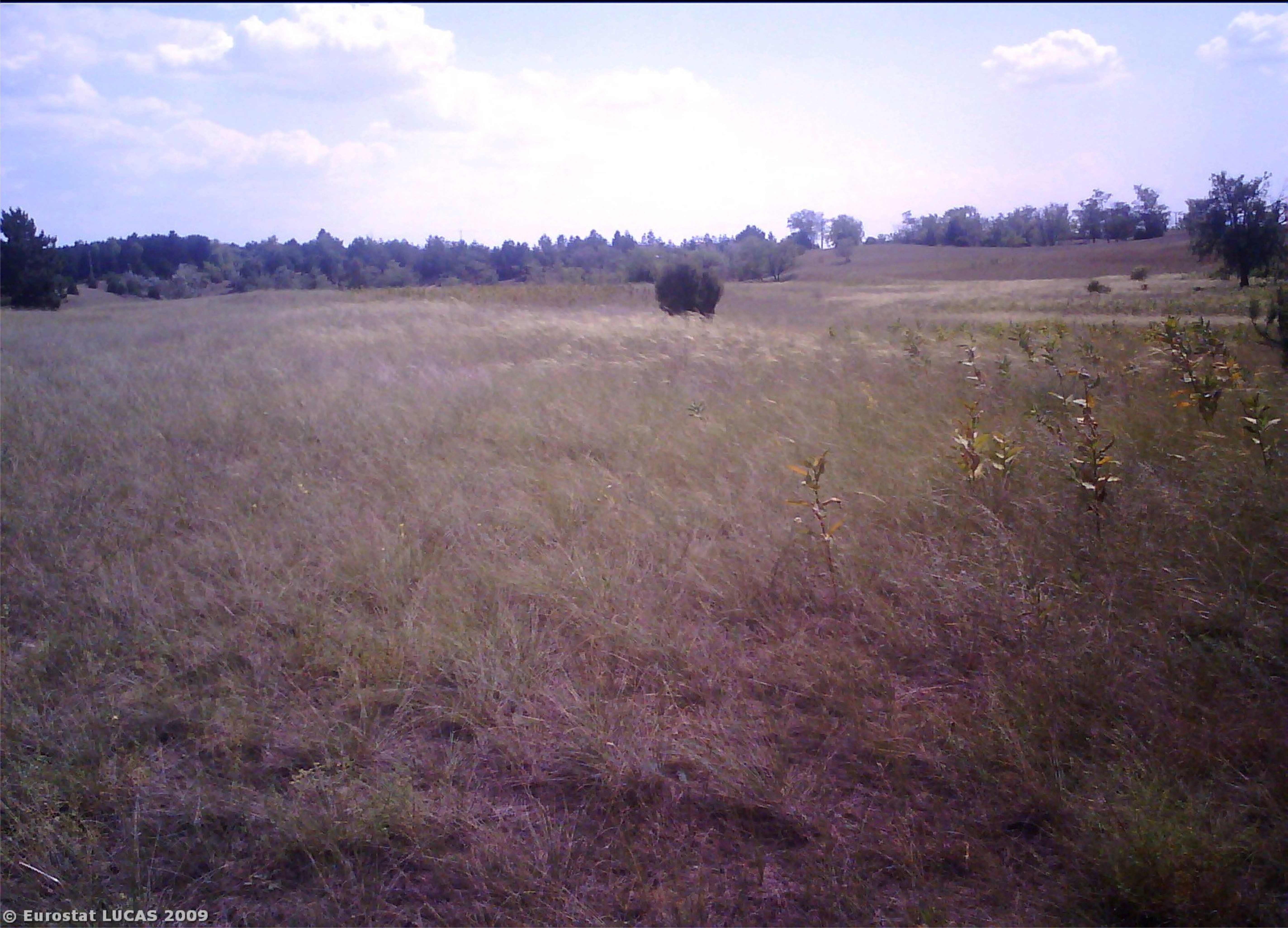
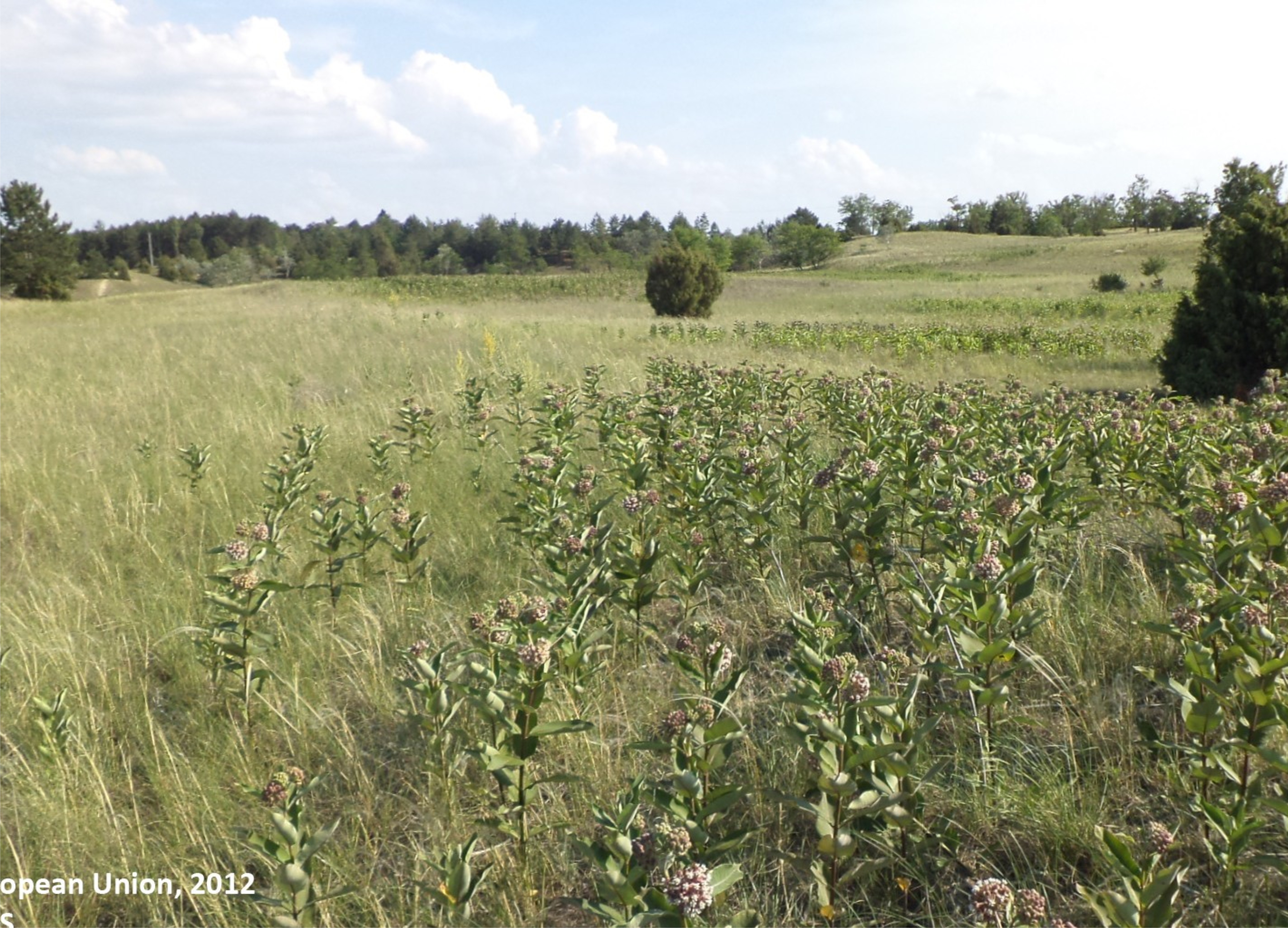
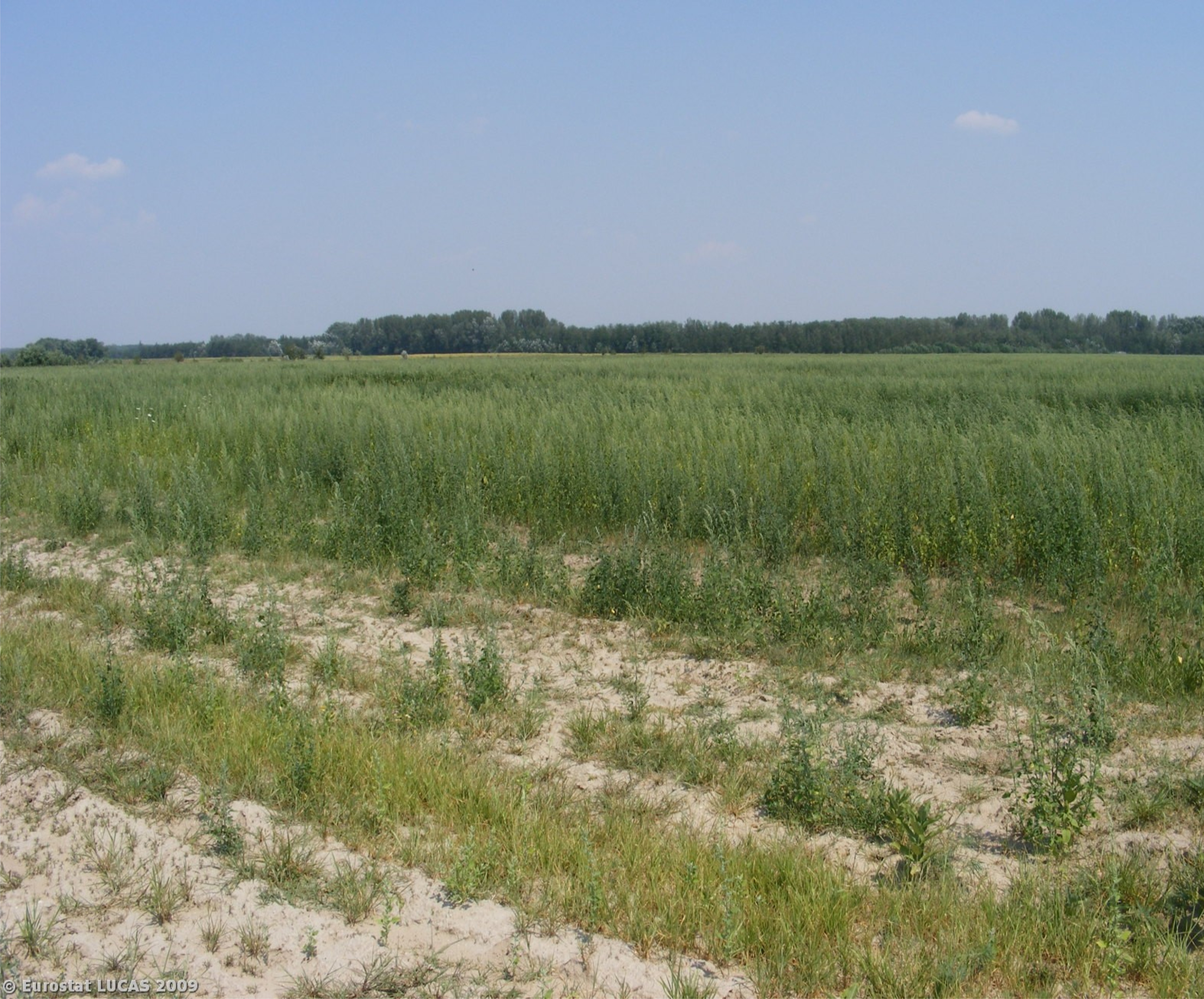
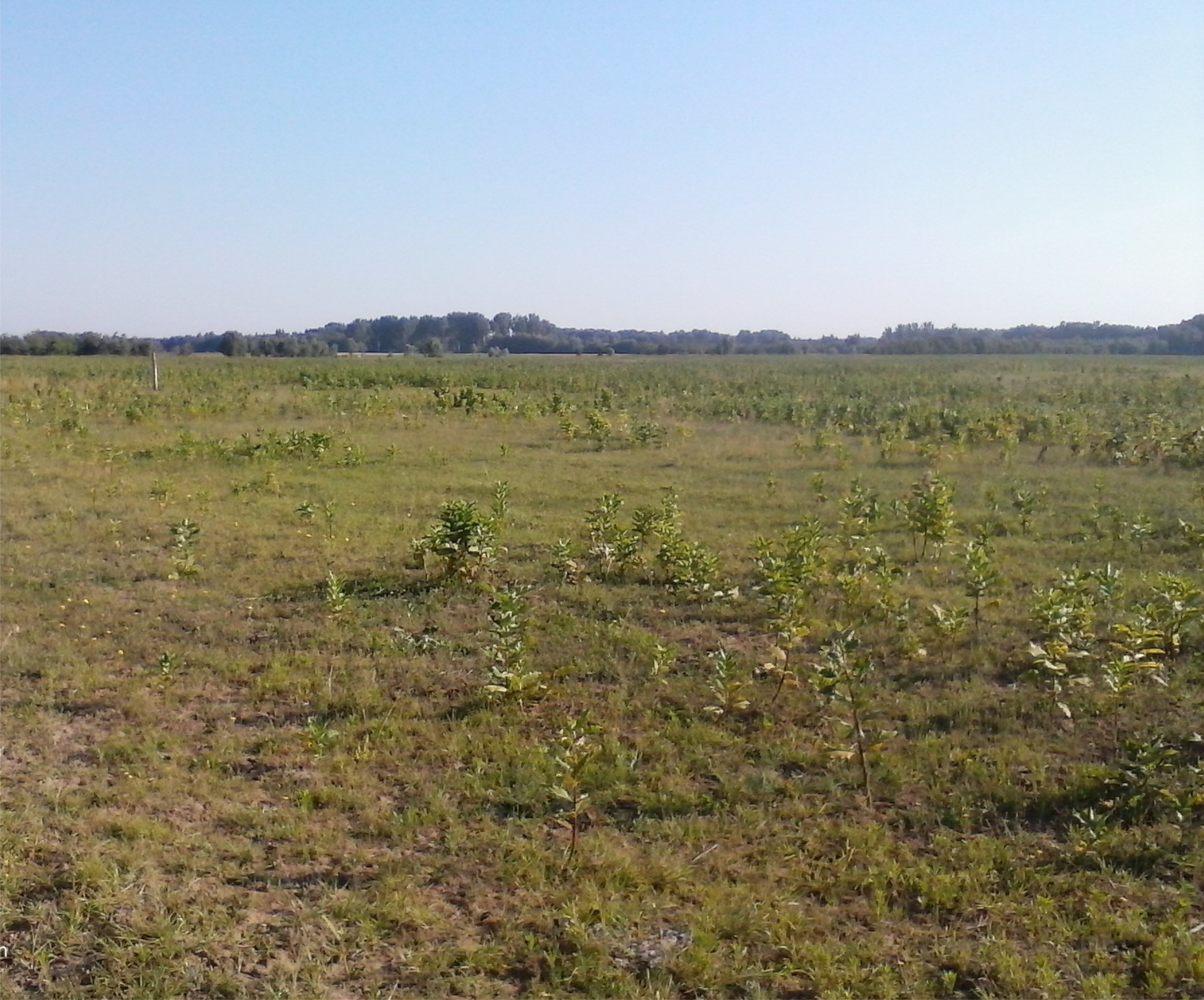
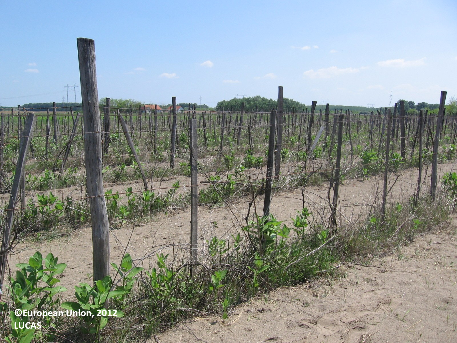
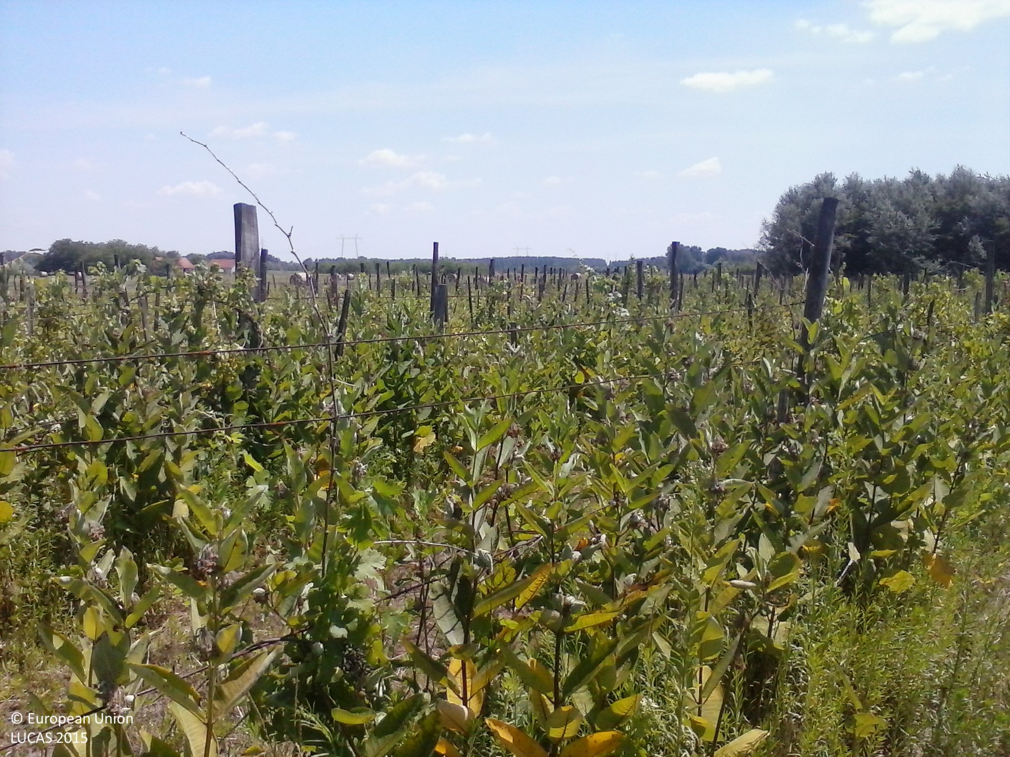
LUCAS photos
Land Use and Coverage Area frame Survey (LUCAS) is a point-based database by EUROSTAT. In each survey point, four photos were taken in the 4 main directions of the landscape. The survey is repeated every 3 years. Consequently, it was possible to identify and categorise the changes over the years. The study area was the Southern Great Plain. In all, 15 130 photos were revised and the infection was quantified based on the following classification:
– clear areas (no infection)
– softly infected points
– moderately infected points
– heavily infected points
As a result, the hot spots of the infection became visible. Most of this invasive plant can be found in the sand ridges in Duna-Tisza Interfluve and the number of infected areas is significantly growing based on the time-series data.
Data collector mobile app
We integrated the developed ‘Invasive Plant Hunter’ application into this project, to have ‘territorial’-scale information about the infected areas in the most endangered parts of the country. More info: here.
UAV mapping
The local-scale UAV survey was carried out with the state-of-the-art Cubert UHD-185 hyperspectral camera and CarbonCore Cortex X8 octocopter in 138 spectral bands at very high spatial resolution as a collaboration with Hungarian Academy of Sciences. Spectral information from the visible and near-infrared range in a highly infected area allowed us to determine the spectral characteristics of common milkweed. Using machine learning, we classified the multidimensional orthomosaic based on field reference data: using sampling quadrats. All quadrats were recorded and photographed, and the resulting database enabled the classification.
Classification
Using field training and validation data, different classification and machine learning methods (Spectral Angle Mapper, Support Vector Machine, etc.) were tested, together with Minimum Noise Fraction Transform (MNF) and Principal Component Analysis (PCA) on our data. The best reached producer accuracy of the class of common milkweed was 73.6% (92.95% overall accuracy). Furthermore, an Artificial Neural Network was also developed. Based on the collected data, using the ANN model we reached 99.61% overall accuracy.
RapidEye
For the regional scale survey, RapidEye multispectral satellite imagery with 5 m spatial resolution was used for the most infected parts of the region. For training and validation data, we used the extended points of the modified LUCAS database. This study found highly infected areas within the Kiskunság National Park where we had previously conducted our local scale study and accurately delineated the infected areas that served as training areas for the UAV analysis. This means that we were able to identify the same infected areas at two different scales using two completely different methodologies with two independent databases.
Project Outputs
The current project greatly contributed to be able to create the National GIS Database of Invasive Plant Species of Hungary which includes several invasive species of the region which endangers biodiversity. You can access the database: HERE.
See Project Publications
|
|
|
|
|
|
|
|
|
|
|
|
|
|

Our present research was supported by “Time series analysis of land-cover dynamics using medium and high-resolution satellite images” NKFI-6 K124648 project and by grant TUDFO/47138-1/2019-ITM of the Ministry for Innovation and Technology, Hungary and the WATERatRISK project (HUSRB/1602/11/0057).


